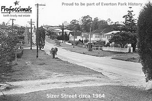
Everton Park – A great community

Professionals Keith Brady Real Estate are proud to be part of local history and the local Everton Park community. We have serviced the Everton Park and surrounds areas for over 30 years and are located in the original post office.
Urban development
The estate adjoining Kedron Brook; made up of McIlwraith, Gordon, Griffith, Burwood, and Brook Streets; was offered for auction in 1885 as the Everton Park Estate. The area grew once the Enoggera to Gaythorne railway was completed in 1916. This allowed more people to easily commute to the city.
The school opened in 1934 as the Bunyaville State School. Prior to that the children had to travel to Enoggera. The name was changed to Everton Park State School in 1954.
The first of the nearby Sparkes Hill reservoirs was completed in 1941. Even then horses were used in the construction process and they were involved in much of the excavation work. At that time there was a lot of urban development in the areas of Stafford, Everton Park, and Grovely. A further reservoir was commissioned in 1954 to service the new Housing Commission estates in the area.
Notable residents
The McDowall family lived on South Pine Road near Kedron Brook. This suburb owes its name to the McDowall family who apparently came from Everton in Liverpool. The bridge over the creek here was named McDowall Bridge.
Joseph Poultney ran a sawmill on the corner of South Pine and Stafford Roads opposite Gordon Parade at that time.
John Tucker ran the first receiving office for mail in 1899 from his property on the corner of South Pine Road and Gordon Street. He had a small general store attached to his home and the mail was collected daily from Tom Raymont’s store in Alderley. By 1908, business had increased along with the local population, and Tucker built a new post office. He moved the old post office and shop to the rear of the property and used it to store and sell produce.
Landmarks
One of the long gone landmarks of Everton Park is the horse and cattle watering trough, which once stood under and old grey gum at the intersection of South Pine Road and Stafford Road. The local bowls club has adopted it as their emblem.
The areas along the creek between Everton Park and Gympie Road were known for their tanneries and slaughter yards and the accompanying smell and water pollution. It continued to be a problem despite the introduction of laws against pollution in 1886. In 1923 the International Health Advisory Board’s expert in sanitary engineering recommended various changes to the industries. Those failing to comply were closed down. Ultimately, many slaughter yards were forced to close when the state government started up Cannon Hill public abattoir in the 1930s.
Current landmarks include the Sparkes Hill Reservoir in nearby Stafford and the Woolworths bulk store on South Pine Road.
Reference: Mary Howells, BRISbites, 2000